ESRI Field Maps Advanced Training

Publishing from ArcGIS Pro to ArcGIS Online (AGOL)
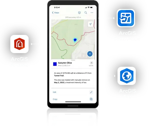
+ Field Maps Designer Workflow

Register Here

Register Now – Space is Limited!

AllTerra Academy

Training Services

give you access to a wide range of support options by product type. Keep you and your staff educated on our equipment and software workflows.

Coming up is our ESRI Field Maps Basic Training course, with specialize training for ArcGIS workflows.

In this training we will cover:

  • Overview of ArcGIS Pro and Geodatabase Design/Domains
    • Create a Geodatabase including Feature Dataset, Feature Class (w/ Z values & Attachments), and Attribute Field Creationt
    • Run Add GPS/GNSS Metadata Tool
    • Create Geodatabase Domain and point the appropriate attribute field to the appreciate Domain
  • ArcGIS Pro Symbology, Configuration, & Publishing
    • Set symbology, labels, display scale ranges, etc.
    • Configure Pop-Ups on Each Feature Class in the Table of Contents (TOC)
    • Configure attribute field precision on Float/Double Field Types
    • Publish an editable Feature Layer(s) to AGOL with proper Group Sharing
  • Create Web Map in AGOL, including the Published Feature Layer(s), and properly setup Web Map settings and Group Sharing
  • Use the Field Maps Designer and setup Attributes (Forms) that will be available when actively collecting features in the field
    • Create an Arcade Attribute Expression to show meaningful Mean Sea Level Elevations when using a high accuracy receiver
    • Create an Arcade Attribute Expression to pull addresses automatically from the nearest Parcel or Address Point Layer, and assign said address to an attribute field in the active layer being collected.
    • Create an Arcade Attribute Expression to automatically & mathematically calculate depth/length/etc. (i.e., automatically subtract an invert depth with the Manhole Rim elevation from the active point feature being collected.
    • Review Offline Maps and Geofencing within the Field Maps Designer
    • Review App Settings within the Field Maps Designer
    • Review Sharing
    • Adding Existing Layers for reference (or for Address extraction into active layer being collected)
  • Bring published map and/or feature layers back into ArcGIS Pro for future live review of field-collected synced data
  • Open ESRI Field Maps on Handheld Device to show Data Collection, Syncing (with and without offline maps), etc.
  • Review Field-Collected Data in the Web Map and ArcGIS Pro
  • Q&A

Training Led By

Zach Edwards

AllTerra Central Mapping & GIS (MGIS)
Training & Support Lead


Zach Edwards is the Mapping & GIS (MGIS) Training & Support Lead for AllTerra Central, Inc. and is based in Albuquerque, New Mexico. Zach has been with AllTerra Central for 4.5 years. He has 18 years’ experience as a GIS professional with 9 years of this being in field data collection solution sales, training, & support. Zach has a solid understanding of GIS mapping and techniques, a deep knowledge of geographic theory gained through research, relevant academic coursework, and work experience. He also has a passion for geodetics and bridging the gap between Land Surveyors and GIS Professionals. Zach has a Bachelor of Arts in Geography from Bowling Green State University (2005) and a Master of Applied Geography from New Mexico State University (2008). Zach also teaches GIS, Photogrammetry, and GNSS coursework in the Geographic Information Technology (GIT) program at the Southwestern Indian Polytechnic Institute (SIPI) in Albuquerque.

Have questions for Zach before the training?

He is waiting by to assist you!

I consent to receive SMS from AllTerra Central, Inc. Reply STOP to opt-out; Reply HELP; Message and data rates apply; Messaging frequency may vary.
Let us know how we can help: