866.565.4936
 Speak to Sales

Intuitive:
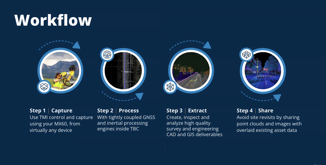
The Trimble mobile mapping system offers easy installation with proven hardware and quick setup using familiar single-cable connections. Its user-friendly field software allows for seamless navigation, enabling precise point cloud capture and immersive imagery for efficient asset management and maintenance.

Powerful:
Equipped with industry-leading Trimble LiDAR and positioning technology, the system captures high-resolution 360° panoramic imagery and road details with a dedicated rear camera. The robust office software allows for easy export and sharing of deliverables, integrating smoothly into various applications and cloud-based solutions.

Efficient:
Cover large areas with varied terrain without requiring multiple setups, road closures, or permits. The system streamlines data collection, delivering high-quality results efficiently and offering a safer, more productive alternative to traditional methods.

Road
The MX60 captures highly accurate data for road asset management, enabling teams to efficiently map, inspect, and maintain roads. From monitoring road conditions to planning repairs, the MX60 ensures precise, real-time data collection to enhance road safety and performance.

Cities & Urban area asset management
The MX60 captures highly accurate data for road asset management, enabling teams to efficiently map, inspect, and maintain roads. From monitoring road conditions to planning repairs, the MX60 ensures precise, real-time data collection to enhance road safety and performance.

Rail
For rail infrastructure, the MX60 allows for rapid and accurate mapping of rail networks, tracks, and surrounding areas. This helps streamline inspections, detect potential issues, and improve maintenance planning, ensuring smoother and safer rail operations.

Mining
The MX60 supports efficient mapping in large, complex mining environments. It provides high-resolution data for terrain analysis, equipment tracking, and operational planning, helping to optimize productivity, safety, and resource management.

Utilities & fiber to the home
The MX60 offers precise mapping for utilities and fiber optic installations, ensuring accurate documentation of underground and above-ground assets. It helps streamline maintenance, minimize disruptions, and improve network planning for utilities and fiber-to-the-home projects.

Tunnels
In tunnels and confined spaces, the MX60 excels in capturing detailed data for inspections and maintenance. Its advanced technology enables thorough mapping of tunnel structures, helping identify potential issues and support long-term infrastructure stability.
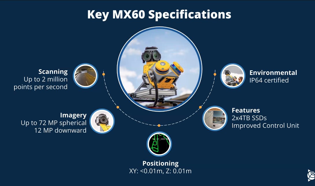
What new capabilities does the MX60 have now?
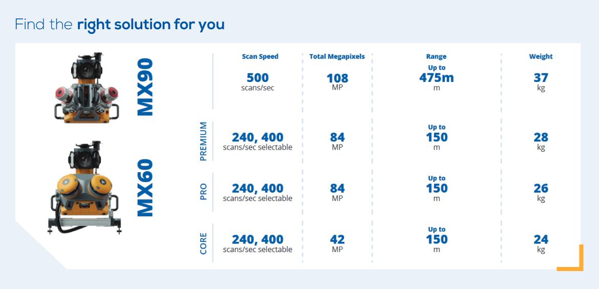
Which MX60 version is best suited for which workflows?
Is the MX60 and field software available on a term basis?